Best of The Snake
Total Distance :: 37.3 miles
Driving Time :: 1 hour 30 minutes
Ride Summary : This outstanding motorcycle ride samples some of the best of the combination of roads that make up the rides known collectively as The Snake. Enjoy some very challenging curves with a favorite Tennessee loop ride which dips a corner in Virginia.
Ride Description
The loop starts on US 421 just north of Mountain City, Tennessee in the farmland, but quickly starts a twisty climb into the mountains and forest. Road quality is good, and you can expect decent tire grip through the challenging curves. This first section is a favorite ride for those who enjoy a spirited approach to the road.
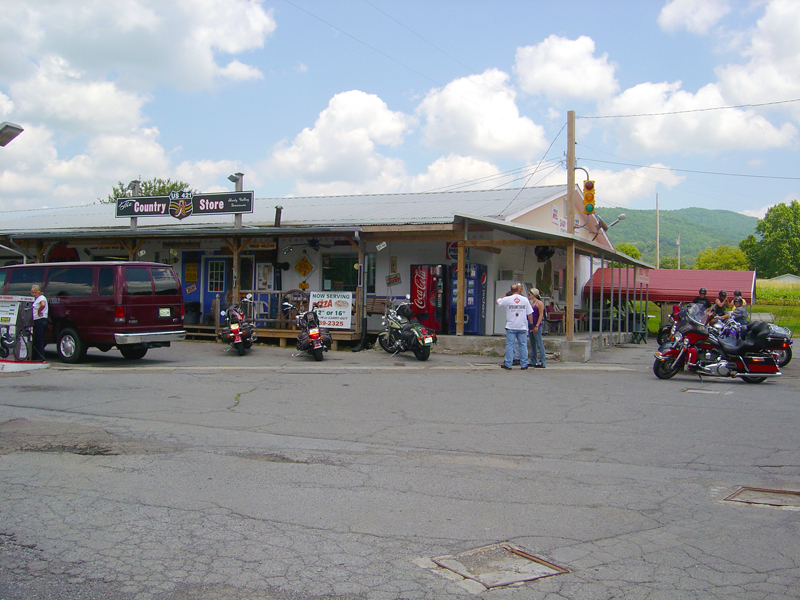
This section ends when you reach country store which sits in virtual isolation at the crossroads. It's a popular spot for a break, a bite to eat, refuel, and get your Snake T-shirts and memorabilia.
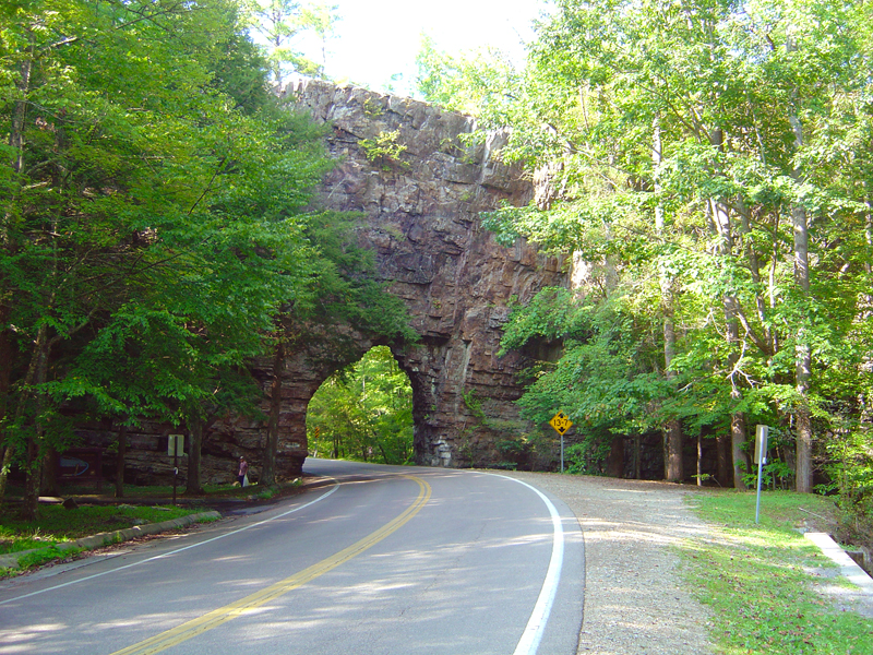
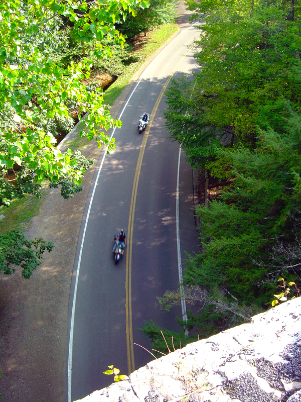
TN 133 leads into national forest and is a pleasant ride with a nice sequence of turns to keep it interesting. Rounding a curve you'll enjoy the sudden appearance of Backbone Rock where the road passes through a small tunnel. Nice place for a rest stop, and there's a steep trail to reach the top of the rock. Don't forget the photos.
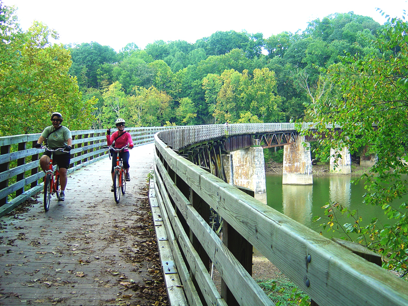
Leaving Backbone Rock behind, you soon cross into Virginia and arrive in the funky little town of Damascus. It's a vortex for hikers and kayakers, but the big game in town is bicycles as it sits at the midpoint of the Virginia Creeper Trail. Thousands come to enjoy this converted railway and ride through the scenic countryside.
Turn right to pass through town on US 58, then veer south onto TN 91 and cross back into Tennessee with a nice engaging ride through the woods.
Watch for the left turn onto Cold Springs Road which leads out into the countryside and avoids returning to town. Make the left turn to stay on Cold Springs Road when it appears to go on unpaved.
Interactive Map
To use the interactive map, you can click on any of the waypoints for more information (see key below map for details on the different waypoint icon types). You can also click on the route segments for detailed directions. Since we use the Google Maps interface, you can pan and zoom easily. Also, you can drag the "Person Icon" above the zoom bar to the route for a 360° tour using Google Maps Streetview system.
| This Ride Sponsored By: |  |
Map Key:
![]() Start of Ride
Start of Ride
![]() Intersection Marker
Intersection Marker
![]() Scenic Point
Scenic Point
![]() End of Ride
End of Ride
Elevation Profile
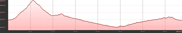
Elevation Information
- Lowest Point: 1919'
- Highest Point: 3904'
- Average Elevation: 2566'
Grade Information
- Max Uphill Grade: 14%
- Max Downhill Grade: -9.6%
- Avg Grade: 2.9%
Mile by Mile Directions
- Mile 0 :: Start at US 421 and Old Cold Springs Road
- Mile 9.8 :: Turn right onto TN 133 at the Shady Valley Store
- Mile 19.7 :: Backbone Rock
- Mile 21.2 :: Virginia State Line
- Mile 23.1 :: Intersect US Hwy 58 in Damascus. Turn right to pass through town
- Mile 24.4 :: Turn right onto TN 91
- Mile 25.9 :: Tennessee State Line
- Mile 32.8 :: Turn right onto Cold Springs Road
- Mile 33.4 :: Bear left to stay on Cold Springs Road
- Mile 37.3 :: Arrive close to where you began at Cold Springs Road and US 421 (started on Old Cold Springs Road and US 421 junction; ended on Cold Springs Road and US 421)
Photo Gallery
Click on a square thumbnail to view a larger image.
Attribution
 This motorcycle ride was contributed by Wayne Busch from America Rides Maps. It is one of many great rides featured on map #4 ("Great Rides Near Boone, Banner Elk, and Blowing Rock") in the Blue Ridge Parkway series of Motorcycle Maps. You may purchase this map and other America Rides Maps at the Virtual Blue Ridge Bookstore.