Roan Mountain - The Fast Way
Total Distance :: 42.6 miles
Driving Time :: 1 hour 30 minutes, time for views and photos
Ride Summary : The ride over 6000 foot high Roan Mountain from Tennessee to North Carolina is a well known classic motorcycle route enjoyed by many. There are so many great motorcycle rides found in the surrounding peaks it's usually part of a long day of riding. Here's a "quick" loop ride around the mountain so those on a schedule can enjoy the best of what it has to offer.
Ride Description
The ride starts and ends at the town of Roan Mountain, Tennessee, on US 19 E just 7 miles from the border with North Carolina. Follow TN 143 South into Roan Mountain State Park.
The road will wind along a river then start to climb as you cruise by the picnic sites, pavilions, and campgrounds.
In 5.3 miles watch for Cove Creek Road forking off to the right. A small gas station sits across the road from it. Cove Creek Road cuts along a flank of the mountain in a rolling and twisty ride with occasional views of valleys and horizons few ever see. The road gets smaller and smaller as you near the state line and the pavement ends when you reach it.
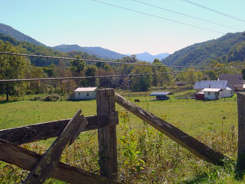
Crossing into North Carolina, there is a 0.3 mile section of road which is not paved, but typically in excellent shape. You're soon on tarmac again, and in the new state the road becomes Hughes Gap Road. Hughes Gap Road flows through a picturesque valley to intersect NC 226.
Turn left onto NC 226 and proceed south for 3.9 miles. Turn left again when you reach Fork Mountain Road.
Fork Mountain Roads leads you east on a 4.1 mile course through a narrow valley and ends when you reach NC 261.
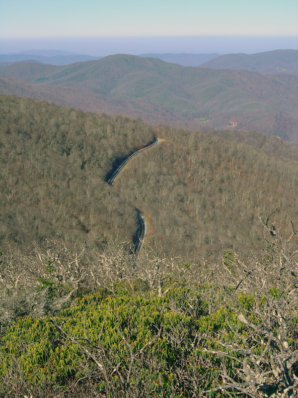
Turn left onto NC 261 to make the last and best leg of the loop with the climb over the mountain. The road twists and snakes through switchbacks as you gain altitude approaching the state line with Tennessee at the crest.
There's a parking area here where you can enjoy the views and access the trails out onto the 6000 ft. high balds.
It's all downhill into Tennessee from here. There are several good paved overlooks so you can savor the glorious long range views of the Volunteer State. Near the bottom of the grade you'll pass by the gas station across from Cove Creek Road and the remaining ride to US 19E is on familiar turf.
Interactive Map
To use the interactive map, you can click on any of the waypoints for more information (see key below map for details on the different waypoint icon types). You can also click on the route segments for detailed directions. Since we use the Google Maps interface, you can pan and zoom easily. Also, you can drag the "Person Icon" above the zoom bar to the route for a 360° tour using Google Maps Streetview system.
| This Ride Sponsored By: |  |
Map Key:
![]() Start of Ride
Start of Ride
![]() Intersection Marker
Intersection Marker
![]() Scenic Point
Scenic Point
![]() End of Ride
End of Ride
Elevation Profile
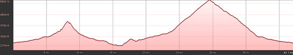
Elevation Information
- Lowest Point: 2374
- Highest Point: 5507
- Average Elevation: 3354
Grade Information
- Max Uphill Grade: 17
- Max Downhill Grade: 13.8
- Avg Grade: 4.4
Mile by Mile Directions
- Mile 0 :: Start at the junction of TN 143 and US 19E in Roan Mountain, Tennessee
- Mile 5.3 :: Turn right onto Cove Creek Road.
- Mile 6.5 :: Cove Creek Road turns into Hughes Gap (Turning right)
- Mile 8.4 :: Reach North Carolina state line - road unpaved
- Mile 8.7 :: Pavement resumes. Road becomes Hughes Gap Road
- Mile 12.7 :: Turn left onto NC 226 south
- Mile 16.6 :: Turn left onto Fork Mountain Road
- Mile 20.7 :: Turn left on NC 261
- Mile 30 :: Reach Tennessee state line at top of mountain
- Mile 37.3 :: Pass by Cove Creek Road continuing now on road you've previously ridden
- Mile 42.6 :: End at the junction of TN 143 and US 19E in Roan Mountain, Tennessee
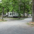
Photo Gallery
Click on a square thumbnail to view a larger image.


Attribution
 This motorcycle ride was contributed by Wayne Busch from America Rides Maps. It is one of many great rides featured on map #5 ("The Best Roads North and South of Asheville, NC") in the Blue Ridge Parkway series of Motorcycle Maps. You may purchase this map and other America Rides Maps at the Virtual Blue Ridge Bookstore.