The Gable End of Hell
Total Distance :: 178 miles
Ride Summary : This ride features small mountain passes through Monongahela National Forest, beautiful farming valleys, and the Cass Scenic Railroad.
Ride Description
The lumberjacks who transformed the isolated town of Cass into a wide open Dodge City each payday are gone. The ringing of axes and the thunder of falling timber no longer echo through this part of the eastern Alleghenies. The sawmill-a massive building packed with belts, pulleys, blades, timber, and men-is gone. Cruising through the town of Cass gives little indication of what used to be the essence of this town's existence-until you reach the Cass Scenic Railroad.
Getting to Cass is a simple matter. Follow Route 41 east out of town through suburbia. Pick up Route 55 east when the two routes intersect. Stay on Route 55 until it joins Route 20 north, and then follow that. I was a little surprised at the amount of traffic on the road in the morning (almost a genuine rush hour), but it was heading in the opposite direction. The northern loop of the route runs out of traffic around Camden on Gauley. Despite the harsh weather and heavy use, West Virginia's state roads are in good condition. Except for the occasional speed zone you can keep it at full throttle.
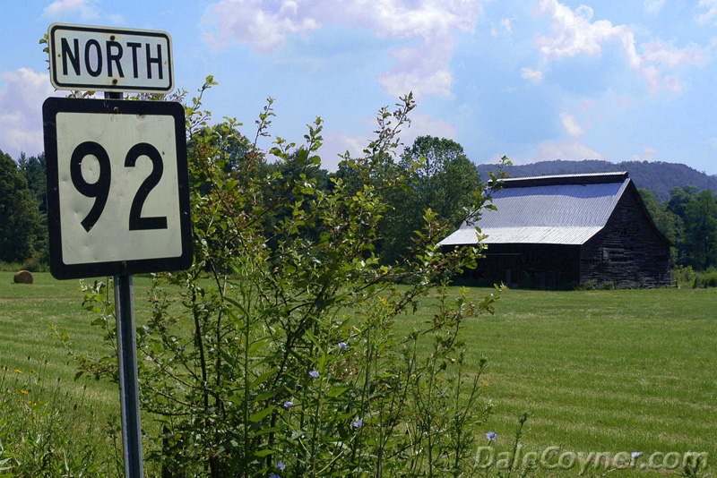
Route 20 passes along the Gauley River on the northern border of the Monongahela National Forest and the Cranberry Recreation Area (see the Cranberry Fields Forever tour, Trip 22) before intersecting with Route 15 at Webster Springs. Turn right and follow it east until arriving at Route 219. Turn right here and head south, deep into the National Forest. I think Route 219 is perhaps my favorite corridor through this area because the road runs at a tangent to the Appalachians.
You get a few miles of mountain passes followed by a scenic valley ride and more mountains. The process repeats itself along the length of US 219, a handy fact to keep in mind if you're planning another ride along this route. The turnoff for Cass is prominently marked as a left off Route 66 near Snowshoe.
The road surface is less refined with some tight, off-camber turns that more aggressive riders will enjoy if only to wear down trailing metal parts. It's hard to believe, but little cowpaths like this were once the main roads through the mountains. They weren't much more than muddy lanes. Can you imagine trying to get through during the spring thaw? Muddy bogs would be more like it.
One of my favorite stories about traveling through this area comes from accounts of two brothers who had more than their share of trouble along this route. The Trotter brothers had the contract to deliver mail from Staunton, Virginia to Parkersburg, West Virginia. After several complaints about their sporadic service, the Postmaster General sent a reprimand from his cozy little office in Washington, D.C.
The brothers had no doubt received some of these complaints in person and this letter was just about the last straw. They responded to the Postmaster's letter, "If you knock the gable end of Hell out and back it up against Cheat Mountain and rain fire and brimstone for forty days and forty nights, it won't melt the snow enough to get your damned mail through on time." The Trotters never heard the Postmaster complain again.
When you roll into the town of Cass, you'll find rows of identical white two-story houses lining the road into town. Except for activity at the train station, a quiet calm settles on the rest of town. Things were different at the turn of the century when the timber operation was in full swing in Cass. It was by most accounts a den of sin and iniquity which thrived on the appetites of hard-living lumberjacks. After working from dawn to dusk seven days a week for months on end, these fellas would get their pay and then head into town for some worldly diversions. The town teemed with saloons, women of ill repute, games of chance, and frequent gunplay.
By the mid-1900s, the timber gave out and the town was on its way to becoming extinct just like so many other small lumber towns. However, fate intervened when the state bought the railroad and most of the town and set it aside as Cass Scenic Railroad State Park in 1963.
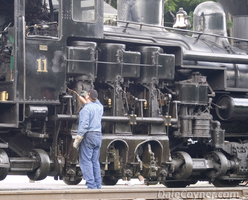
The highlight of the park is a ride up the mountain in converted flatbed cars pulled by Shay locomotives. The Shay engine is a wonderfully complex machine and a triumph of engineering which would be tough to match even today. It was designed to reach timber in the higher elevations that couldn't be reached by ordinary engines. It had to handle heavy loads and negotiate frail tracks laid on steep ground, as much as an 11 percent grade. When you're on the road and see a warning about a 9 percent grade, you know the descent will be steep. Imagine descending that kind of grade hauling a few thousand tons of hardwood!
While you can have a good time just gawking at them sitting still, they're even more fun to ride. If you want a really good look at how they work, board the car nearest the engine. The smoke is thick and the noise deafening as one of these giant black beasts gets underway, but the real work begins on the slopes. Smoke and cinders begin to rain down in clouds so heavy the entire mountain range is obscured until you change directions. The smell of burning coal fills your lungs and permeates your clothing. And you'll nearly jump out of your skin the first time the engineer grabs a handful of steam whistle as he approaches an intersection.
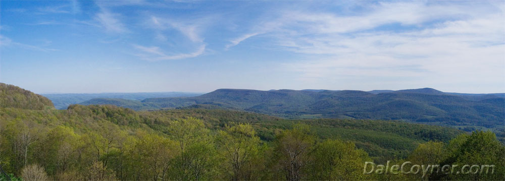
You can take two different runs, depending on the amount of time you have. One train runs three times a day to an intermediate point at Whittaker Station, once a regular stop along the line and now the place where dinner trains stop during the summer season. That ride lasts about an hour and a half. For a longer ride and even more tremendous views, the ride to Bald Knob leaves once a day at noon and requires four and a half hours to make the run. Fall color runs are nothing short of spectacular.
The Whittaker Station run is $9 and Bald Knob is $12. That price also includes admission to the wildlife and historical museums. You can also walk along a footpath that passes by the old sawmill site and eventually leads to the machine shop where you are invited to visit the engineers who keep these remarkable engines running. Once you debark the train back in the village, take the time to walk around and visit the restored homes and shops.
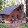
Cass is another company town, with rows of cracker box homes in varying states of repair. You can rent a restored company home here, and, like at other West Virginia state parks, it comes with everything you need. Be sure to visit their website for a current calendar and rate schedule, because there are many special runs and events. Of the many attractions I have visited in West Virginia, Cass has the greatest entertainment value for the dollar.
While you're in the area, you may wish to visit the National Radio Astronomy Observatory (see Highlander Loop tour, Trip 16) or visit the Cranberry Glades (see Cranberry Fields Forever tour, Trip 22). Retrace your steps along Route 66 to Route 219 and follow it south. Turn right and follow the Highland Scenic Highway (Route 150) along the tops of the mountains. When you're touring a route through a remote area like this it's easy to understand why some people in the Appalachians seem to be from a different time. That kind of isolation also breeds superstition and a deep-rooted belief in witches, demons, and past life experiences.
Around here they still tell the tale of a man who had strong flashbacks of something that happened to him in a former life. He could clearly recall a vision of his two brothers in a past life murdering a man. He remembered helping them move the body into a limestone cave and placing it on a shallow ledge in the cave. He never told anyone about it because he thought it wasn't real. Some time later, his son was exploring limestone caves in the Blue Ridge area, and taking photographs of them.
One of the pictures looked remarkably like the vision his father kept seeing, prompting him to tell his family about it. His son revisited the cave with the intention of proving to his father that the vision was only imagination. He entered the cave, walked a short distance, and found a ledge. Shining a flashlight over the edge, he discovered a human skeleton, fossilized by water dripping through the limestone. It was later determined that the skeleton was at least 200 years old. Had any visions of a former life lately?
When Route 150 ends, turn right and follow Route 39/55 through Richwood and into Summersville. Pleasant dreams . . .
Interactive Map
To use the interactive map, you can click on any of the waypoints for more information (see key below map for details on the different waypoint icon types). You can also click on the route segments for detailed directions. Since we use the Google Maps interface, you can pan and zoom easily. Also, you can drag the "Person Icon" above the zoom bar to the route for a 360° tour using Google Maps Streetview system.
| This Ride Sponsored By: |  |
Map Key:
![]() Start of Ride
Start of Ride
![]() Intersection Marker
Intersection Marker
![]() Scenic Point
Scenic Point
![]() End of Ride
End of Ride
Elevation Profile
Elevation Information
- Lowest Point: 1459'
- Highest Point: 4543'
- Average Elevation: 2900'
Grade Information
- Max Uphill Grade: 9.0%
- Max Downhill Grade: -10.6%
- Avg Grade: 2.9%
Mile by Mile Directions
- Mile 0:: Depart WV 41 East out of Summersville at junction US 19 and WV 41
- Mile 6.5 :: Continue straight where WV 41 joins WV 55
- Mile 12.0 :: Continue straight where WV 20 joins WV 55
- Mile 34.7 :: Right on WV 15 East in Webster Springs
- Mile 64.0 :: Right on US 219
- Mile 75.3 :: Left on WV 66
- Mile 85.8 :: Arrive Cass Scenic Railroad State Park, then turn around
- Mile 96.3 :: Left on US 219
- Mile 110.0 :: Right on WV 150 (Highland Scenic Highway)
- Mile 132.5 :: Right on WV 39
- Mile 178.4 :: Arrive Summersville via WV 39 West
Photo Gallery
Click on a square thumbnail to view a larger image.
Attribution
 This ride was provided by Dale Coyner, author of Motorcycle Journeys Through The Appalachians. You can find this ride along with many others in his book available for purchase at the Virtual Blue Ridge Bookstore.