Mid-Winter Valley Special for Hampton Inn and Suites

Hampton Inn and Suites - Cashiers Sapphire Valley

Hampton Inn and Suites - Cashiers Sapphire Valley

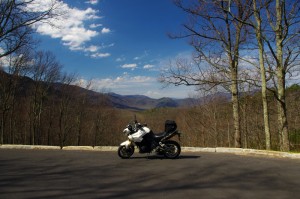
Greetings Fellow Motorcyclists!  Our friends at The Hampton Inn and Suites of the Cashiers/Sapphire Valley in North Carolina are offering an exclusive offer to stay in their private mountain retreat by staying with them before March 31st, 2012.

Their fabulous Mid-Winter Valley Special is meant to lift your spirits and remedy cabin fever. The special price offer is $79/night (Friday to Saturday) and $69/night (Sunday to Thursday).  The price includes all applicable taxes and the standard hotel amenities.   The only way to get the special rate is to call the hotel directly at 828-743-4545 and ask for the Winter Valley Special!

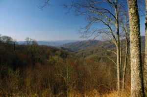
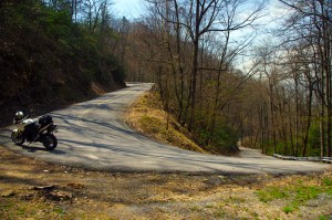
The area boasts several warmer days for riding your motorcycle in late winter and early spring as it is in the lower elevations on the eastern escarpment of the Blue Ridge Mountains about 40 miles south of Asheville, NC.  Our  Wild Dam Waterfall Loop goes right in front of Hampton Inn and Suites and makes for a great starting point for a tour through the "Land of Waterfalls."  Situated right off of Hwy 64 East in Sapphire, NC, the curvy mountainous ride will please in and of itself.

You'll enjoy beautiful and comfortable rooms and suites with modern convenience in a quaint mountain setting at the Hampton Inn and Suites. Standard king or queen rooms are available, as well as king and queen studios and suites. Many rooms have mountain views! All rooms have microwave and mini-fridge, free wireless Internet access, coffeemaker, hairdryer, iron and ironing board. There is also a complimentary hot breakfast and beverages; indoor pool and whirlpool; fitness room; Business Center and meeting facilities.

Wild Dam Waterfall Loop

100 miles out on the Blue Ridge Parkway, my motorcycle was stuck in top gear

I’d dropped the bike. Pulling out from a back road along the Blue Ridge Parkway, a car suddenly appeared out of the dense clouds rounding a curve and I stalled the engine on the incline.  It went down hard on it’s left side breaking a turn signal lens and mangling the clutch and shift levers. Minor damage considering I’d avoided the car, but it would prove enough to make the trip home a challenge.

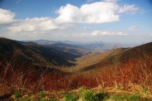
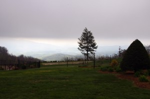
Photo - View From Switzerland Inn

The nicest weather came just before my meeting at the Switzerland Inn - http://SwitzerlandInn.com

Already modified from a prior incident (click to read about that debacle) the shift lever was now wedged beneath the side stand. The clutch lever flopped precariously but it was working, and with a decent foot effort I managed to pry the shifter upwards and snick through the gears to get moving again towards Asheville. It was when I tried to downshift for a curve the real problem became apparent. I could not shift into a lower gear.

Thankfully I was on the Blue Ridge Parkway, uninterrupted in its 469 mile length. No stops, no traffic lights, it would be a manageable inconvenience to be restricted to a single gear. The problems would come when I left the parkway and entered the city traffic. At least I’d have plenty of time to come up with a plan on how I’d get home without slowing or stopping.

Photo - bad weather on the Parkway

It's days like this a waterproof camera comes in handy on the Blue Ridge Parkway

Trying to bend the shift lever into a more useful shape was a last resort. Previously bent once, it would likely break if I stressed it any more. I decided I’d need to find a way home where I would not need to stop even once.

Traffic was light. The weather was already miserable at these high elevations and would continue to deteriorate as a strong front moved in. The wind gusted powerfully, rain squalls spit at me, and I was enveloped by thick clouds as I passed by the signs for Mt. Mitchell, then Craggy Gardens. The low fuel light came on as I drew near to Asheville but I knew there was no way I could negotiate traffic, stopping was not an option. I decided I must go on.

In 20 miles or so I’d reach the US 276 exit south of Waynesville. If I could get off the parkway without stalling, then make it down through the switchbacks on the steep incline, there would be but one traffic light to gamble on to reach home.

Cresting the rise that led into Bethel, I saw the light blink from red to green and rolled on the throttle to cleanly pass through it. 10 minutes later I pulled into my driveway. Just another day on the road.

A little video from the day -

http://www.youtube.com/watch?v=j57PPHa_vVI

Smoky Mountains Adventurous Spring Motorcycle Ride Photos

Photo - Soco view

Morning view on Soco Rd - Click on pics for LG view

15 minutes from home and already I was fighting the urge to jump off the motorcycle and start snapping pictures. It was a beautiful Smoky Mountain spring morning. Rounding every curve the canvas repainted another fabulous scene as I droned down from the Blue Ridge Parkway at Soco Gap towards Cherokee.

Photo - view from Clingman's Dome

Clingman's Dome view

Not a car on the road ahead of me, I let the bike stretch it’s legs through the curves effortlessly riding every last inch of rubber as my Triumph Tiger charged down the incline in pursuit of it’s prey.

Photo - view from Roaring Fork Rd

Roaring Fork Road - must be Roaring Fork!

It felt so good, all is right with the world when you’re on your motorcycle in the mountains. Wrapping around a rock face with the mellow grace of a cat arching it’s back, I flicked left to begin my plunge to the valley floor on the first of the new roads I’d see today.

Photo - hairpin curve on Alpine Rd

Alpine Rd - one of my newest favorites

How had I missed this road? I’ve bypassed it many times on my passages to Cherokee. It’s not like I haven’t studied the area and it’s so close to home. Yet when we came through on a motorcycle ride Saturday, a road I was vaguely familiar with suddenly jumped out at me and said, “Come back and take a closer look”.

Photo - Cherokee Orchard Rd

Cherokee Orchard Road Overlook

The clue  that tipped me off  was the name – “Old Soco Road”. It suggested I was riding the “new” Soco Rd (US 19). “Old” Soco Rd was the way things used to be. Sometimes these “old” roads are gems.

It was like riding off a cliff and I had to quickly adapt to the more primitive road surface. Gliding through turn after turn I delicately parachuted through the  loose gravel and the windblown debris that had rained down on the switchbacks on this third day of roaring mountain wind. April was coming in with a bang.

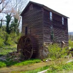
Photo - Old mill

I passed this old mill again today

So began a day that took me across Great Smoky Mountains National Park and out into the wilds to the north as I clicked off road after road on my search for the best motorcycle rides. The afternoon would bring me into a violent storm navigated on what were now familiar byways through seemingly remote and isolated hidden valleys where angry streams threatened to crest their banks and wash across the pavement.

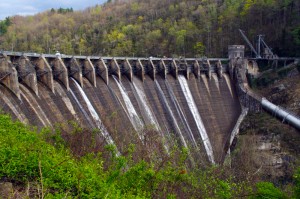
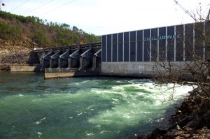
Photo - Tapoco Dam

The Dam at Tapoco

Looping around the west side of Great Smoky Mountains National Park near the end of the day, I’d arrive at Deals Gap to find the motorcycle resort closed due to the lack of electricity as a wind blown forest fire raged up a flank of the park consuming the lines and felling trees in it’s path. I’d squeeze through a gap between the fire trucks parked on a back road to ride through the smoke and smolder where crews fought the flames and mended the wires.

As the day drew to an end the lightening and rains caught up to me again, followed me home bringing the fury of the storm with them, and toppled trees that would have me without power for the next few days.

I’ve lost a couple days of work and will now double-down to make it up. With each new day the grays and browns of winter give way to the soft pastel greens of emerging leaves as spring wrestles the cold grip from the old season to bring the warm blooms of the new.  The fuse is lit for the explosion of color. It’s time to point your wheels towards the high country, its ready for you.

Motorcycle the Dragon, the Cherohala Skyway, the Blue Ridge Parkway in one day

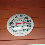
Photo - Thermometer at Deals Gap Motorcycle Resort

Thermometer at Deals Gap Motorcycle Resort

It was 80 degrees when I pulled up at the Deals Gap Motorcycle Resort yesterday at 5 PM with over 400 miles of Smoky Mountain motorcycle rides already behind me. 8 hours ago I was on the Cherohala Skyway as the soft morning glow and gusty winds made the lonely road seem like it was in another world.  I decided to make the day a trifecta and go home via the Blue Ridge Parkway. It’s hard to believe it’s still March, early spring has arrived!

Photo - morning on the Cherohala Skway

Morning on the Cherohala Skyway. I'm parked on the state line between North Carolina and Tennessee.

I had reservations about going out today, I’d been putting it off. I knew I would not find many good motorcycle rides in the areas I was searching. It was either too far out of the mountains or too far to into them. I was hitting the single lane back roads in the National Forests near The Dragon at Deals Gap and the Cherohala Skyway,  as well as the best ways to pass through the semi-urban areas to the north.

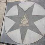
Photo - marble campfire

Who knows where this is?

I found something cool out in the Cherokee National Forest that will get it’s own motorcycle blog post shortly. One of the more useful things I discovered is one of the most direct ways to connect The Dragon at Deals Gap to I-75 south of Lenoir City.

Photo - Cherohala Skyway View

A long view of the Cherohala Skyway as it winds into Tennessee

I suspect many riders follow US 129 to Maryville, then take US 321 north when headed for the Interstate. There is  a way to minimize the traffic and avoid more than half of the four lane US 321.

Take TN 72 north from The Dragon at Punkin Center. When you reach US 411, cross it onto the East Coast Tellico Parkway and follow it along the lake area. It will become Axely Chapel Road at the north end and will intersect US 321. These are not outstanding motorcycle rides, but they are a heck of a lot better than the alternatives and get you off the four lane on some scenic and curvy motorcycle roads.

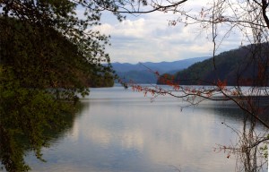
Photo - Calderwood Lake

Calderwood Lake is one of several along US 129

I don’t really care much for riding in this area, but it’s only because there are so many really great motorcycle rides once you get in close to Great Smoky Mountains National Park. It’s hard to shine when pitted against them.

I’ve been mostly focusing on find the connections between the better rides so you can link them together. If you have the time when passing through, they are the most enjoyable motorcycle rides I can find for those who would rather stay on the back roads and savor them. The views are certainly more entertaining. Watch out for turkeys in the road.

Photo - Chillowhee Dam

How many of you have seen the Chillowhee Dam from this side?

My “wake up and dream” cruise on the smooth and sweeping curves of the Cherohala Skyway was the highlight of the morning.  The rest of it was on a web of roads which weave through the more remote and rugged sections of the national forest. A few of them start out as decent paved roads, but quickly diminish to single lane unmarked trails that become more potholed and full of gravel as you go. On most, the pavement ends long before the road does.

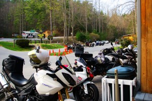
Photo - motorcycles at Delas Gap Motorcycle Resort

5 PM on a Tuesday evening in late March at the Deals Gap Motorcycle Resort

I’ll need at least one more good day to cover this area as thoroughly as I’d like. I’ve hit almost all the roads. The challenge now is how they work together to become the best motorcycle rides through the area, how well do the linked roads flow, can I find ways to make the good motorcycle rides last longer?

I know I can!

(Click on photos for larger views)

Blue Ridge Parkway Opens Soon, Smoky Mountain Motorcycles Everywhere!

Motorcycle the Blue Ridge Parkway

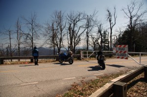
We parked our motorcycles at the Blue Ridge Parkway gates at Wagon Road Gap. It wasn't open today, but it will be soon.

I knew before we reached the top of the climb the gates to the Blue Ridge Parkway would be closed. The fresh layer of road salt as we glided through the last of the hairpin curves on our motorcycle ride up US 276 south of Waynesville, North Carolina, were evidence of the lingering snow I’d seen on the mountainsides last night. Thin sheets of ice on the roadside rock faces reminded me just how different the world is when you climb up high where the Blue Ridge Parkway crowns the ridge tops.

Photo - waterfall along Buck Springs Trail

Many come to enjoy the hiking nearby. One of several small cascades the Buck Springs Trail shares on it's 6 mile run to the Pisgah Inn.

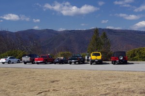
In the midday warmth, the dusting of white had vanished, but it was not long gone. We found the gates closed at Wagon Road Gap, but a nearly full parking lot at the Cold Mountain overlook proved we were not the only ones who were eager to enjoy the emergence of spring via the nations most popular motorcycle ride.

Photo - Blue Ridge PArkway overlook - Cold Mountain

Cold Mountain Overlook at Wagon Road Gap, Blue Ridge Parkway - Even with the parkway closed, plenty came out to enjoy the hiking, the scenery, and the warm weather on such a nice day.

Photo - Jackie on her Beemer

Come on, Let's Go ! This is great!

It’s early for the Blue Ridge Parkway to be open to traffic at the south end. This is the highest, and in my opinion, the best section of the entire 469 mile motorcycle ride.  If you see just one piece of the Blue Ridge Parkway on your motorcycle vacation, this should be it, the section from Asheville to the south end of the parkway at Great Smoky Mountains National Park near Cherokee. Because it’s the highest section, it’s usually the last to open for the start of the spring season.

The number of outstanding roads that surround and connect to the Blue Ridge Parkway in this area is enough to keep you busy for a season and then some. It was just one stop on a great day of motorcycle rides that followed.  I think we passed more bikes then cars on our ride. If you had a motorcycle, you were out to enjoy it today.

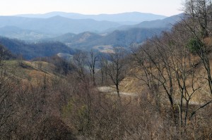
Photo - view from Crabtree Mountain Road

A view from Crabtree Mountain Road north of Canton. You can see a portion of it as it snakes it's way through the pass. Soon, this will all be green and spring flowers.

We doubled back via US 276 then cruised through Canton and headed north on Crabtree Mountain Road. I’d forgotten what a steep climb it was and how tight the switchback  curves are that bring you to the nice overlook at the top of the mountain pass. Up one side, down the other, then follow the serpentine path of the stream that flows through the valley. On to NC 209, out to Hot Springs, then hop from one great motorcycle ride to the next until you’ve had your fill.

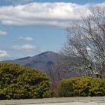
Photo - view form blue ridge parkway overlook

Before long, everything will be green and flowers!

It won’t be long until weather like this will be what we expect every day in the Smoky Mountains. The fields are already turning green. The first tiny leaves are emerging on the brush. Buds are fat and swelling almost ready to burst on the trees. Soon, the hillsides will explode with color as all that pent up winter energy is freed. From what I’ve seen so far, the motorcycles are ready for it. Are you?