The Diamondback - NC 226A
Total Distance :: 12 miles
Driving Time :: 30 minutes
Ride Summary : The Diamondback - NC 226A is a densely wooded trek, from Marion in McDowell County to Little Switzerland, on the edge of Mitchell County, NC at Milepost 334. An exciting and challenging drive, the two-lane route has smooth, well-marked pavement, flanked by rocky outcroppings, shear drop-offs and quick, tight hairpin curves.
Ride Description
Just outside Marion, NC, The Diamondback - NC 226A - has more than 190 steep, climbing curves in just 12 miles. The temperatures cool as you climb the steep switchbacks looping almost 360 degrees. Runs of S-curves climb and twist sharply as they snake through lush green forest en route to the Blue Ridge Parkway just above Spruce Pine, North Carolina.
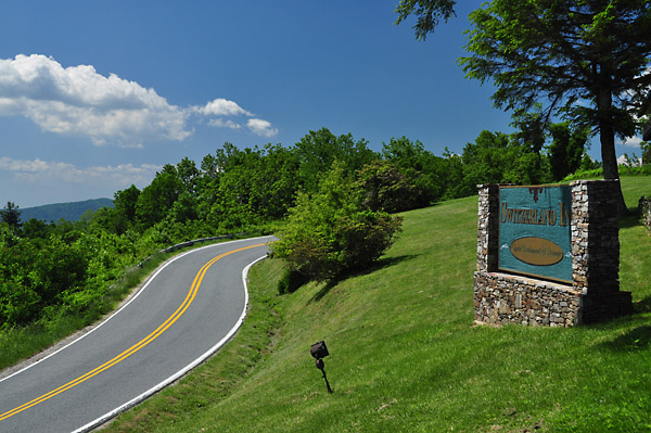
At its peak, The Diamondback joins the Parkway above Little Switzerland, NC. Expansive views of the mountain valley, shopping, dining and beverages, plus full-service accommodations and recreational amenities are available at Milepost 334.
Half the fun is getting there via The Diamondback - NC 226A. Sweeping curves, amazing scenery and cool mountain breezes make The Diamondback, NC 226A, a quick, fun route to North Carolina's Blue Ridge Parkway.
Interactive Map
To use the interactive map, you can click on any of the waypoints for more information (see key below map for details on the different waypoint icon types). You can also click on the route segments for detailed directions. Since we use the Google Maps interface, you can pan and zoom easily. Also, you can drag the "Person Icon" above the zoom bar to the route for a 360° tour using Google Maps Streetview system.
| This Ride Sponsored By: |  |
Map Key:
![]() Start of Ride
Start of Ride
![]() Intersection Marker
Intersection Marker
![]() Scenic Point
Scenic Point
![]() End of Ride
End of Ride
Elevation Profile
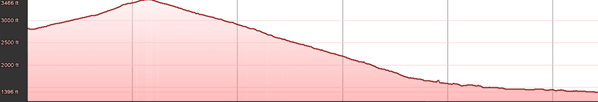
Elevation Information
- Lowest Point: 1396'
- Highest Point: 3466'
- Average Elevation: 2354'
Grade Information
- Max Uphill Grade: 14.9%
- Max Downhill Grade: -19.7%
- Avg Grade: 3.7%
Mile by Mile Directions
- Mile 0 :: Take exit ramp from BRP at Milepost 334, at end of exit ramp take a left onto NC 226A
- Mile 2.4 :: Intersection with Chestnut Grove Rd
- Mile 13 :: Ends at US 221 - NC 226
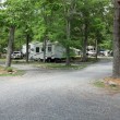
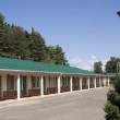
Photo Gallery
Click on a square thumbnail to view a larger image.