Motorcycle the Dragon, the Cherohala Skyway, the Blue Ridge Parkway in one day

Photo - Thermometer at Deals Gap Motorcycle Resort

Thermometer at Deals Gap Motorcycle Resort

It was 80 degrees when I pulled up at the Deals Gap Motorcycle Resort yesterday at 5 PM with over 400 miles of Smoky Mountain motorcycle rides already behind me. 8 hours ago I was on the Cherohala Skyway as the soft morning glow and gusty winds made the lonely road seem like it was in another world.  I decided to make the day a trifecta and go home via the Blue Ridge Parkway. It’s hard to believe it’s still March, early spring has arrived!

Photo - morning on the Cherohala Skway

Morning on the Cherohala Skyway. I'm parked on the state line between North Carolina and Tennessee.

I had reservations about going out today, I’d been putting it off. I knew I would not find many good motorcycle rides in the areas I was searching. It was either too far out of the mountains or too far to into them. I was hitting the single lane back roads in the National Forests near The Dragon at Deals Gap and the Cherohala Skyway,  as well as the best ways to pass through the semi-urban areas to the north.

Photo - marble campfire

Who knows where this is?

I found something cool out in the Cherokee National Forest that will get it’s own motorcycle blog post shortly. One of the more useful things I discovered is one of the most direct ways to connect The Dragon at Deals Gap to I-75 south of Lenoir City.

Photo - Cherohala Skyway View

A long view of the Cherohala Skyway as it winds into Tennessee

I suspect many riders follow US 129 to Maryville, then take US 321 north when headed for the Interstate. There is  a way to minimize the traffic and avoid more than half of the four lane US 321.

Take TN 72 north from The Dragon at Punkin Center. When you reach US 411, cross it onto the East Coast Tellico Parkway and follow it along the lake area. It will become Axely Chapel Road at the north end and will intersect US 321. These are not outstanding motorcycle rides, but they are a heck of a lot better than the alternatives and get you off the four lane on some scenic and curvy motorcycle roads.

Photo - Calderwood Lake

Calderwood Lake is one of several along US 129

I don’t really care much for riding in this area, but it’s only because there are so many really great motorcycle rides once you get in close to Great Smoky Mountains National Park. It’s hard to shine when pitted against them.

I’ve been mostly focusing on find the connections between the better rides so you can link them together. If you have the time when passing through, they are the most enjoyable motorcycle rides I can find for those who would rather stay on the back roads and savor them. The views are certainly more entertaining. Watch out for turkeys in the road.

Photo - Chillowhee Dam

How many of you have seen the Chillowhee Dam from this side?

My “wake up and dream” cruise on the smooth and sweeping curves of the Cherohala Skyway was the highlight of the morning.  The rest of it was on a web of roads which weave through the more remote and rugged sections of the national forest. A few of them start out as decent paved roads, but quickly diminish to single lane unmarked trails that become more potholed and full of gravel as you go. On most, the pavement ends long before the road does.

Photo - motorcycles at Delas Gap Motorcycle Resort

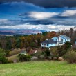
5 PM on a Tuesday evening in late March at the Deals Gap Motorcycle Resort

I’ll need at least one more good day to cover this area as thoroughly as I’d like. I’ve hit almost all the roads. The challenge now is how they work together to become the best motorcycle rides through the area, how well do the linked roads flow, can I find ways to make the good motorcycle rides last longer?

I know I can!

(Click on photos for larger views)

My Search for the Best Mountain Motorcycle Rides Never Ends

Photo - Maple Springs Observation Point

The Maple Springs Observation Point - accessed from Santeetlah Rd

Friday’s search for great Smoky Mountain motorcycle rides, which culminated with a spirited cruise on the Cherohala Skyway, was one of those days that might be looked on as not so productive. It’s not that I didn’t catalogue some good mountain motorcycle riding roads, I added several which will appear on my new map of the area. In my quest to leave no stone unturned, much of the 400 miles I covered was spent on roads which only the most adventurous would bother to travel. Still, there are sights and places some may wish to see, and I’m determined to find as many of them as I can.

Photo - Cherokee National Forest View

View from the Maple Springs Observation Point. I was told you can see 5 states from this spot.

Considering the number of motorcycle riders who are drawn to the area by such notable roads as The Dragon at Deals Gap, the Cherohala Skyway, The Tennessee Foothills Parkway, NC 28 (now renamed “the Moonshiner 28“), finding others that compare in quality is pretty much futile. These are some of the best motorcycle rides in the world. I’m not holding my breath thinking I’m going to discover the next great classic motorcycle ride. So why go to all this effort?

Photo - Santeetlah Dam

Quiet morning at the Santeetlah Dam

There are probably millions of motorcycles that pass through here each year. In most cases, they come, they ride the famous roads, get the t-shirt, then they’re gone to other places following the crowds. It’s the notable roads that get all the attention. Once experienced, it’s back on the four lane or the congested tourist arteries to reach the next great spot. You can rack up a lot of miles playing connect-the-dots, though those droning plods on the connections are the price you pay to reach those popular motorcycle rides.

Photo - Bald River Falls

Bald River Falls

It doesn’t have to be that way. I’m filling in the gaps between the famous motorcycle rides with the best quality rides I can find so connecting the dots is as much of an adventure as the roads you’re trying to reach. Where others might show you one good way to get from point A to point B, I look for all the best ways.

Photo - Cherohala Skyway View

View from the Cherohala Skyway. The Smoky Mountains were especially smoky today and I'll get more photos another time.

Who want’s to spend their time on the 4 lane or in bumper to bumper tourist traffic when there are so many empty two lane scenic and challenging mountain roads that get bypassed? It’s often as simple as crossing over to the next valley to escape the congestion. One little turn can make the difference between cruising along with the wind in your face or cursing the throngs of dawdling codgers, gawking sightseers, lumbering RV’s, and belching commercial trucks struggling up the grades to deliver their wares.

Photo - Motorcycles on the Cherohala Skyway

Bikes on the Cherohala Skyway

I’ve catalogued more than 100 good motorcycle roads so far surrounding Great Smoky Mountains National Park. I’m not done yet. Some of these are outstanding rides. Others will satisfy those looking for adventure. All of them avoid most everyone else who’s come to enjoy the Smoky Mountains just like you and take you to the places they’ll never see while getting you where you want to be.

Keeping you going is what keeps me going. I’m closing in on finishing the map of the Best Motorcycle Rides North of Great Smoky Mountains National Park. Stay tuned and see what I discover. It’s all for you. (Click on the photos for the large versions)


http://www.youtube.com/watch?v=xBbQfR2GqMc

The Motorcycle Ride that Shouldn’t Be There – Go with the Flow

Photo - old mill in Tennessee

Sights like these are the rewards for exploring the back roads. So few ever see them.

“Turn around. Go back. You’re missing something”. The signs were there, little hints and clues that more was going on than meets the eye. It was near time to head for home but I couldn’t shake those compelling thoughts and I swung the motorcycle around.

I’m not unfamiliar with the area. I’d studied it in depth and detail and ridden through it seeking out great motorcycle rides of which I’d already found a slew. I was on such an exploration now following a road I’d selected as having a good chance of being a decent ride, and it had rewarded me with a nice twisty rolling romp through the foothills of English Mountain in Tennessee that my motorcycle seemed to enjoy as much as I did. Still, I felt there was more here.

Photo - Douglas Dam, Sevierville, Tennessee

My travels included a stop at the Douglas Dam near Sevierville. While not very scenic in winter, it's a nice place for a break.

I wasn’t sure exactly where I was. It’s not that I was lost, I knew contextually where I was in relation to other roads and landmarks. But the road names were not familiar anymore, they didn’t match what I had planned out on paper. That happens often enough as I don’t so much ride by the suggestions on the map but by how the roads flow one into another – the natural route. I’d turned left at the stop sign to see where this new road connected to the main artery, but I’d seen it maintained it’s character to the right as well, and it was calling me back.

The natural flow of a ride is something thats very hard to pick out from a map or satellite imagery.  When a web of roads connected and intersect, there’s typically a path of least resistance. It’s the instinctual choice you make when two roads meet, the split second decision you make to follow the dominant or more interesting road as you cruise along. It’s the way that keeps you moving, keeps the ride going, it’s what you’re looking for.

Photo - B&W view from the Foothills Parkway

It was a cool, damp, overcast day, a mood better captured without color. View from the Foothills Parkway on my way home.

I couldn’t ignore the clues. The old mill I’d stumbled upon meant this was a long established community that had been connected enough to support such commerce. There would be old roads leading to it. There was the sign for Hidden Caverns – roads to tourist attractions are usually well kept. As I started up the valley, the “Chains and 4-Wheel Drive Required in Winter” sign told me somebody had a reason to go this way, even when the snows come.

The climb was “steep as a mules face” and I expected the quality of the pavement to evaporate as I reached the heights, yet it maintained. Heck, there was even a painted line you could make out in places – that’s a good sign. I rolled on with pretty much certainty the road would just end when the mountaintop was reached, but it didn’t. It snaked around the crest a bit, then plunged down the back side. It was easy to pick the right path up high as all the connecting roads were unpaved, but as I cascaded towards the valley I went with the flow, following the natural course of one road leading into another. The lower I got the more certain I was this ride would lead to familiar territory, but where would it come out?

I finally came to a stop sign and recognized where I’d arrived. I knew this next road, it was one I’d already selected as a great motorcycle ride. It led to more. I then realized where I must have travelled, through an area where I didn’t think there was a decent paved road, an empty white space on the map no longer. It had already been a good day. This great motorcycle ride was the icing on the cake. I can’t wait to go back!

Blue Ridge Parkway Opens Soon, Smoky Mountain Motorcycles Everywhere!

Motorcycle the Blue Ridge Parkway

We parked our motorcycles at the Blue Ridge Parkway gates at Wagon Road Gap. It wasn't open today, but it will be soon.

I knew before we reached the top of the climb the gates to the Blue Ridge Parkway would be closed. The fresh layer of road salt as we glided through the last of the hairpin curves on our motorcycle ride up US 276 south of Waynesville, North Carolina, were evidence of the lingering snow I’d seen on the mountainsides last night. Thin sheets of ice on the roadside rock faces reminded me just how different the world is when you climb up high where the Blue Ridge Parkway crowns the ridge tops.

Photo - waterfall along Buck Springs Trail

Many come to enjoy the hiking nearby. One of several small cascades the Buck Springs Trail shares on it's 6 mile run to the Pisgah Inn.

In the midday warmth, the dusting of white had vanished, but it was not long gone. We found the gates closed at Wagon Road Gap, but a nearly full parking lot at the Cold Mountain overlook proved we were not the only ones who were eager to enjoy the emergence of spring via the nations most popular motorcycle ride.

Photo - Blue Ridge PArkway overlook - Cold Mountain

Cold Mountain Overlook at Wagon Road Gap, Blue Ridge Parkway - Even with the parkway closed, plenty came out to enjoy the hiking, the scenery, and the warm weather on such a nice day.

Photo - Jackie on her Beemer

Come on, Let's Go ! This is great!

It’s early for the Blue Ridge Parkway to be open to traffic at the south end. This is the highest, and in my opinion, the best section of the entire 469 mile motorcycle ride.  If you see just one piece of the Blue Ridge Parkway on your motorcycle vacation, this should be it, the section from Asheville to the south end of the parkway at Great Smoky Mountains National Park near Cherokee. Because it’s the highest section, it’s usually the last to open for the start of the spring season.

The number of outstanding roads that surround and connect to the Blue Ridge Parkway in this area is enough to keep you busy for a season and then some. It was just one stop on a great day of motorcycle rides that followed.  I think we passed more bikes then cars on our ride. If you had a motorcycle, you were out to enjoy it today.

Photo - view from Crabtree Mountain Road

A view from Crabtree Mountain Road north of Canton. You can see a portion of it as it snakes it's way through the pass. Soon, this will all be green and spring flowers.

We doubled back via US 276 then cruised through Canton and headed north on Crabtree Mountain Road. I’d forgotten what a steep climb it was and how tight the switchback  curves are that bring you to the nice overlook at the top of the mountain pass. Up one side, down the other, then follow the serpentine path of the stream that flows through the valley. On to NC 209, out to Hot Springs, then hop from one great motorcycle ride to the next until you’ve had your fill.

Photo - view form blue ridge parkway overlook

Before long, everything will be green and flowers!

It won’t be long until weather like this will be what we expect every day in the Smoky Mountains. The fields are already turning green. The first tiny leaves are emerging on the brush. Buds are fat and swelling almost ready to burst on the trees. Soon, the hillsides will explode with color as all that pent up winter energy is freed. From what I’ve seen so far, the motorcycles are ready for it. Are you?